Day 1
Cocora Valley to Finca La Argentina
Length: 9.9km
Alt. Start: 2,400 m
Final altitude: 3,400m
Departure: 8am
ETA: 4pm
Lunch: The Forest
We meet at the Salento Trekking office at 8:00 am. m. to be ready to leave at 8:30 a.m. m. and hop on a Willys Jeep for the 12km drive to Valle de Cocora, where our trek begins. The Cocora Valley is a natural cloud forest and home to the Colombian national tree Palma de Cera. This giant wax palm, the tallest in the world with a height of 65 meters, was on the brink of extinction, but came back to life after the Colombian government designated it as a protected area in 1985.
In Cocora, after about a kilometer of easy walking enjoying the beautiful view of the valley, we cross the Quindío River for the first time, enter the Palm Forest and start walking in the jungle. This is also the entrance to Los Nevados National Natural Park created on April 30, 1974.
We will cross the Quindío River twice before our destination. The forest is home to 250 species of birds, including the hummingbird, yellow-eared parrot, blue-crowned motmot, and Andean condor, to name a few. The trail ascends rapidly and we
climb for the next 2.8 km (about 3 hours), crossing the Bosque de Niebla and passing an indigenous cemetery. After approximately one hour (2.5 km) of walking, we will take a break for lunch (altitude 2900 m).
After lunch, we start the 3.5 km walk (2.5/3 hours) that takes us to our final destination, Finca La Argentina. The trail will relax a bit and cross a meadow where raccoons can sometimes be seen walking around. The last 600 meters to Finca La Argentina will again be a bit steeper and will take between 30 and 45 minutes. Dinner at Finca La Argentina.
In case of weather change, the guide determines the safest path.
Day 2
Finca La Argentina to Paramillo del Quindío to Finca la Secreta
Length: 16km
Alt. Start: 3,400 m
Final altitude: 4,700m
Departure: 8am
return: 4pm
Lunch: Bosque or El Berlin
After breakfast, at 7 am, we will head towards Finca Buenos Aires (altitude 3,700 m), in a kilometric stretch of steep ascent where we will take our first break, have a cup of tea or coffee and replenish ourselves with water. After 20 minutes we ar
rive at the Páramo (from 3,750 to 3-750), In this vegetation, we can see the Frailejones.
Later, when we reach 4,200 meters, you will choose your next destination. The first and shortest option is to climb to 4,300 meters and make a descent to El Berlín where we would have lunch and then, going directly to La Secreta arriving; completing a 7-hour itinerary.
As a second option, we can leave our backpacks 1 hour from Paramillo del Quindío, go there and then come back to have lunch at the place where we left our luggage. And finally, we start the 8km walk again that takes us to La Secreta, a family farm, which will be our second night refuge.
In case of weather change, the guide determines the safest path.
Day 3:
La Secreta to Cabaña Potosí entrance to Natural Parks
Length: 11.8km
Alt. Start: 3,600 m
Final altitude: 3922 m
Departure: 8 a.m.
return: 12 noon
Lunch: on the return of the transport
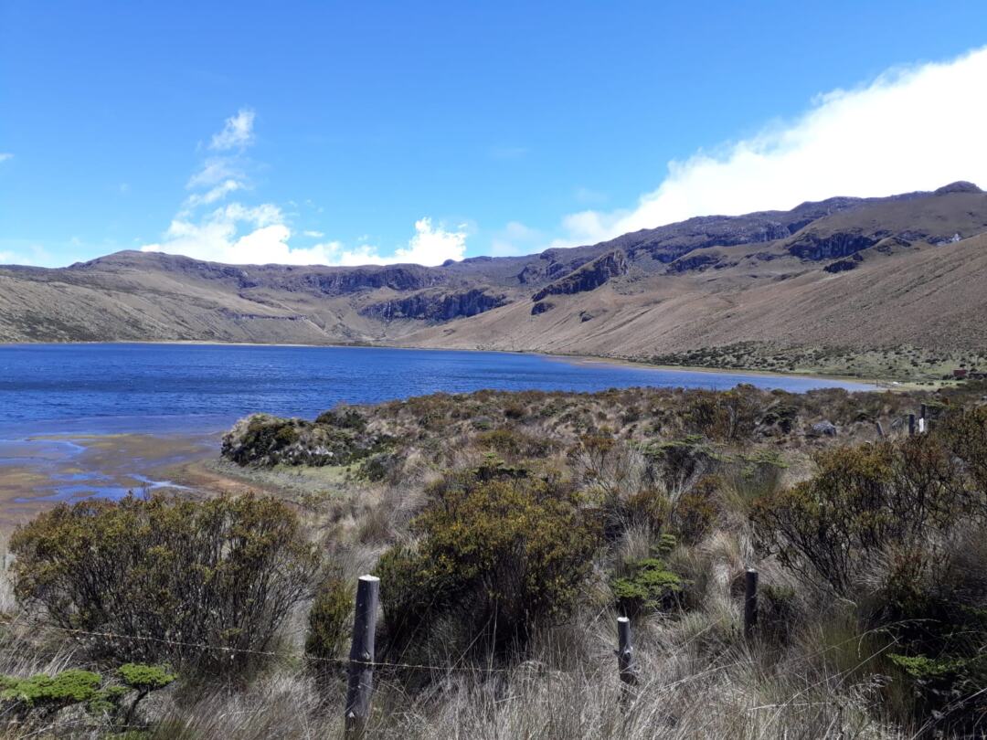
On our third day and according to your destination, we start walking, mostly first thing in the morning with two small climbs, at 6 or 7 am for about 5 hours on a 14 km path, to reach Potosí at 3,922 Mts, the Most of the tour we will be around the Laguna del Otún, we will have sightings of crested, white and royal eagles of the páramo
Finally, another car picks you up and takes you to the bus terminal in Manizales, Caldas for 2 and a half hours. You can pay the driver a little more and he will take you to the airport or back.
In case of weather change, the guide determines the safest path.