Catch the Stars
4 days / 3 nightsLevel of difficulty: Challenging
Minimum altitude: 2,400m
Maximum altitude: 5,260m
Valle de Cocora to Finca La Argentina
Length: 9.9km
Alt. start: 2,400m
Alt. end: 3,500m
Departure: 8am
ETA: 4pm
Lunch: El Bosque
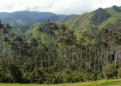
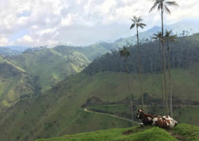
We meet at Salento Trekking office at 8:00 am to be ready to leave by 8:30 am and hop on a Willys Jeep for the 12km drive to Valle de Cocora where our Trek starts. Valle de Cocora is a natural cloud forest and home of the Colombian national tree Palma de Cera. This giant wax palm tree, the tallest in the world growing up to 65 meters, was near extinction but regained life after the Colombian government designated it a protected area in 1985.
In Cocora, after about a kilometer of easy hiking taking in the beautiful view of the valley, we cross the Rio Quindío for the first time, enter the Bosque de Palmas forest and start hiking in the jungle. This is also the entrance into the Parque Nacional Natural Los Nevados created on April 30, 1974.
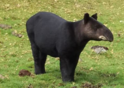
We will cross the Rio Quindío twice before our destination. The forest is home to 250 species of birds including hummingbird, yellow-eared parrot, Blue-crowned motmot and Andean condor to name a few. The trail heads up quickly and we climb for the next 2.8km (about 3 hours), crossing the Bosque de Niebla and passing by an indigenous cemetery.
After about an hour (2.5km) of hiking, we will take a lunch break (altitude 2,900m). After lunch, we head out for the 3.5km (2.5/3 hours) hike that takes us to our final destination Finca La Argentina. The trail will ease up a bit and cross a prairie where sometimes raccoons can be seen walking around. The last 600 meters to Finca La Argentina will get a bit steeper again and take about 30 to 45 minutes. Dinner at Finca La Argentina.
In case of weather change, the guide determines the safest path.
Finca La Argentina to Finca La Playa
Length: 4km
Alt. start: 3,500m
Alt. end: 3,680m
Highest point: 4,400m
Breakfast: 8am
Departure: 9am
ETA: 12pm
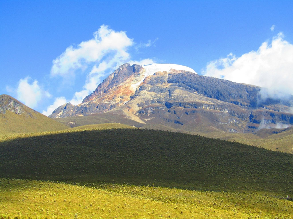
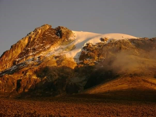
Short hike today as we prepare for ascending the Nevado del Tolima the following day. We head out toward Finca Bueno Aires, on a kilometer steep uphill section. After another kilometer, we reach a point where we can see the Paramillo del Quindío, one of the highest mountains in the Nevados National Park. Sitting at 4,700m, it does not have snow anymore but is as majestic as always.
We continue toward Finca Bueno Aires and hike up to La Cuchilla (4,200m), which marks the “border” between the department of Quindío and Tolima. From there, it is a 2km hike to reach Finca La Playa (3,680m).
In case of weather change, the guide determines the safest path.
Finca La Playa to Nevado del Tolima
Length: 12km
Alt. start: 3,680m
Alt. end: 3,680m
Highest point: 5,260m
Departure: 12:30am!
ETA: 1pm
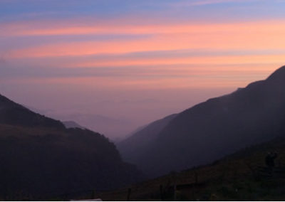
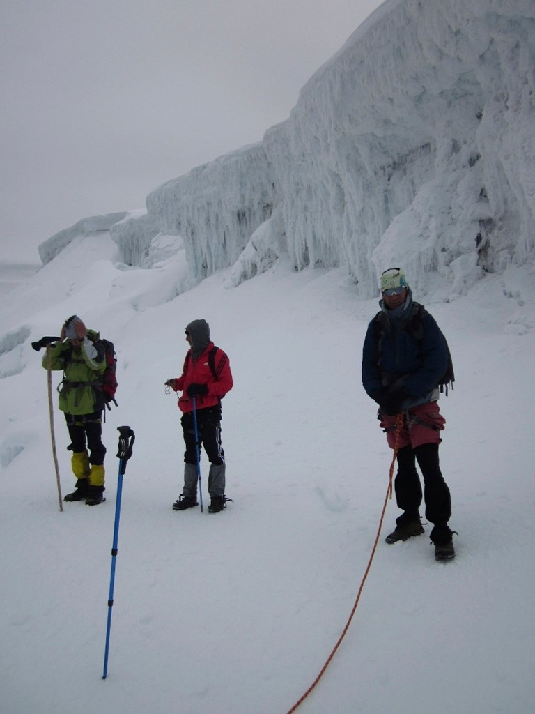
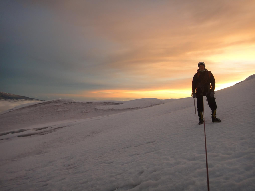
Very early start as we head out before dawn for the 6km trek that awaits us to reach the Nevado del Tolima. The first part of our trek takes us across the Valle of Romerales to the foot of the Nevado del Tolima in about 2 hours. We start climbing on volcanic terrain that brings us to a point called El Calvito (4,300m) as it bears no vegetation. This point starts what is known as the acenso al Nevado del Tolima. Hiking now gets harder as the terrain gets steeper and rocky, and oxygen is getting thinner. We pass by El Helipuerto (4,700m) where we take a break and finally reach the limit of the glacier. We put on the equipment necessary to take on the last 200m and the hour that separate us from the summit. The pain is all worth it as we enjoy the incredible view!
We take the same way back down 6km to the Finca La Playa where we stay another night.
In case of weather change, the guide determines the safest path.
Finca La Playa to Valle de Cocora
Length: 22km
Alt. start: 3,680m
Alt. end: 2,600m
Highest point: 3,800m
Breakfast: 6.30am
Departure: 8 am
ETA: 4pm
The first 2km of the hike is relatively flat as we hike along the crest of the mountain until we reach the Cerro de la Virgin, where we can admire a view of the whole department of Quindío. From there we head mostly down to Estrella de Agua for 2.5km, crossing from the Department of Tolima back into Quindío.
We continue our hike down for another 2.5km passing through el Mirador de Acaime, until we reach the Bosque de Niebla. The last 9km back to Valle de Cocora, our final destination, is mostly downhill with 6 crossing of the river Las Mirlas using suspended wooden bridges – Indiana Jones style but safe! We will celebrate the end of our adventure at our favorite organic restaurant in Cocora.
In case of weather change, the guide determines the safest path.
Image Gallery
What’s Included
- Pre-trek briefing
- Transportation from Salento to Valle de Cocora and back
- Bilingual English/Spanish guide
- 2nd guide for glacier expedition
- Equipment for the climb to the glacier (crampons, helmet, harness and ice axe)
- All meals: 3 breakfasts, 4 lunches, 3 dinners and snacks
- Insurance policy
What’s Not Included
- Breakfast on the first morning
- Dinner on the last night
- Tips for the guide
- Luggage transportation (optional and additional $70,000/day)